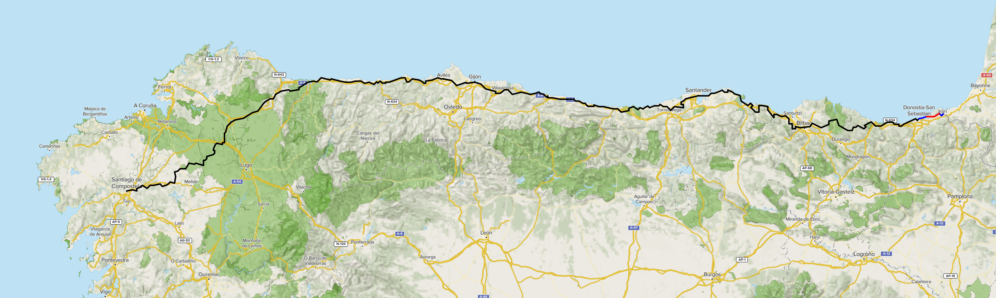
Trail distance: 18.24 km (11.33 mi) -- Total distance: 28.71 km (17.84 mi) -- Total steps: 37,290
Elevation gain: 580 m (1,903 ft)
Moving time: 3 hours 43 minutes -- Total trail time: 4 hours 11 minutes
Camino del Norte distance: 18.24 km (11.33 mi)
Notes:
I am including the trail map that I walked each day, which matches the 'trail distance.' The starting and end points are on the official Camnio route. That is, I enabled the tracking app (AllTrails) at the beginning of the route and stopped at the end of the route of the day, which excludes the distance that I walked from/to the accommodation. Most of the time, I didn't pause and resume when I took a break, such as a quick tour of church, or stop at a restaurant. You can move the cursor on the elevation graph on the top left corner to see where I was on the map. (The elevation graph is from the left to the right, while I am walking from the right to the left on the map, so it's a little confusing.) As you can see, sometimes (especially on the very first day) I got lost (not many times), and you can tell!
I begin the day with a quick tour of Biarritz by renting a bike from the AirBnB host. She charges 10 euros regardless of how long I am renting it. Not a good deal for me, but I still wanted to take a quick look at the city. I ride a bike along a quiet, picturesque lake (Lac de Mouriscot) to the point where I can see the city center.


After a quick tour of Biarritz, I take a train to the border city of Hendaye (in French), or Hendaia (in Spanish) to begin my Camino walk. I am getting excited. Maybe too much...

Just outside the Hendaye train station, toward Spain, there's another train station which leads to Irún, Spain, where I would begin my Camino walkn (well, sadly).

At the Irún station, I see the first sign of Santiago. It's only 840km away, and, well, I am really going to walk!

As I get out of the Irún train station, I see a train station employee helping passengers. I try my rudimentary Spanish to ask where the Camino del Norte begins. Unsurprisingly, she seems rather amused. Maybe my pronounciation is extremely bad, or I am just saying it all wrong. She doesn't know what the Camino de Santiago is! I ask other people outside the train station, but (surprisingly) no one seems to know...
By chance, I meet a young man who definitely looks like a pilgram, or who is walking the Camino. He has been walking from his home in Belgium through France for the past months, and the next day he would begin his Camino del Norte! He was looking for an albergue (a hostel for pilgrims) and I thought I can get help there. The gate to the albergue is closed, but there is a lady inside the gate, 10 meters away, who motions that she couldn't speak, pointing to her throat. Nonetheless, she points to the right side of albergue as the direction of the Camino...
Saying good-bye to the Belgian, I started to walk alone. After walking for 30+ minutes, I realize that I didn't see any Camino sign, and that I have just been walking along the road toward San Sebastián. Well, it's past 1pm, and I am hungry.

With a full stomach, I gather my thoughts. What is happening? Didn't I plan for this trip, but I don't know where to start? I planned for all accommodations, but not the acutal walking??? It struck me that I already installed an app (Buen Camino) on my phone. I turned it on, and realized that I am not on the Camino trail. In fact, I am 20 minutes away from the trail!
It's almost 2pm, and I don't want to go back to the border to begin walking. I decided to go to the nearest Camino trail, and start walking from there.
With the help of the Camino app, now I know exactly where I am. It looks like I am going up the mountain and walk along the ridge.

It's a hot day, easily around 30°C (86°F), and the first 2 days, I am carrying my backpack and a daypack. (Beginning in San Sebastián, the backpack will be transferred by the mail company from an accommodation to the next.) After leaving the restaurant, I look for a store to buy water, since I have only one small (500 mL) bottle of water. I am getting closer to the mountain, and my goodness, I don't see any store that is open! I know I need to walk probably 4+ hours to get to the next town, and it just doesn't look like there's anything on the trail. Well, I just keep following the yellow arrow signs.

Soon after, an uphill (about 2km) begins. Then, I see a steep downhill, and walk down. As I descend further, it feels odd. It's really going down! I looked at the Camino app, and... I am way off the trail! It probably took me 5 minutes to get back to where I made a wrong turn.

As it turned out, I missed a yellow arrow sign for the Camino trail because a car was blocking it. I was walking on the pavement, and missed the beginning of the narrow dirt road... An important lesson learned: When there is a fork on the road, make sure you are choosing the right one. Look for the Camino sign. If not sure, rely on the app.
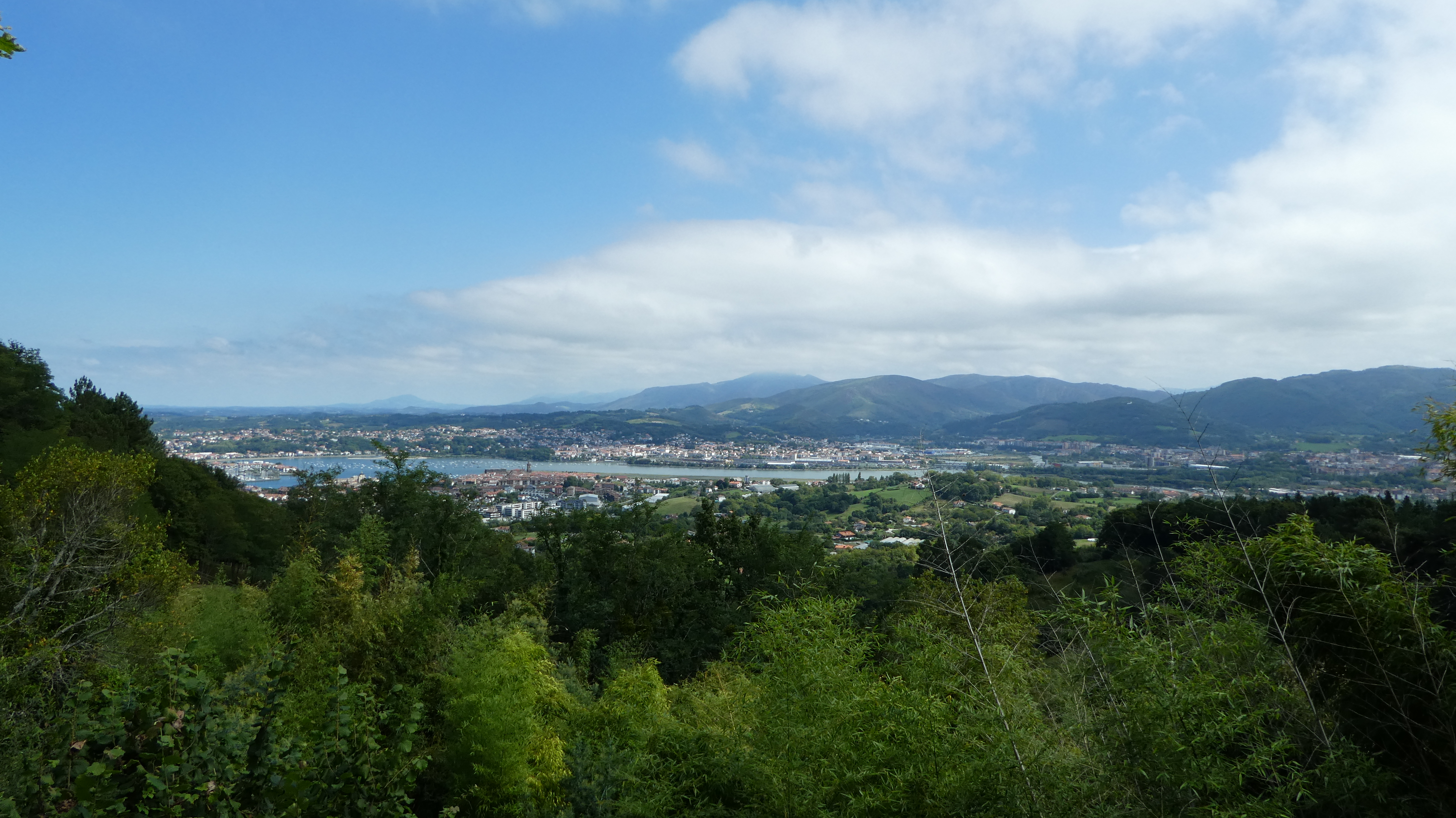
Next 3.3 km is straight up, gaining over 220 m. It may not sound much, but my body is still in the San Diego time zone, not the Camino time zone, and I am carrying a full backpack in a very hot, muggy day. It's tough to go up, but finally, I am on the ridge, and I see Irún below.
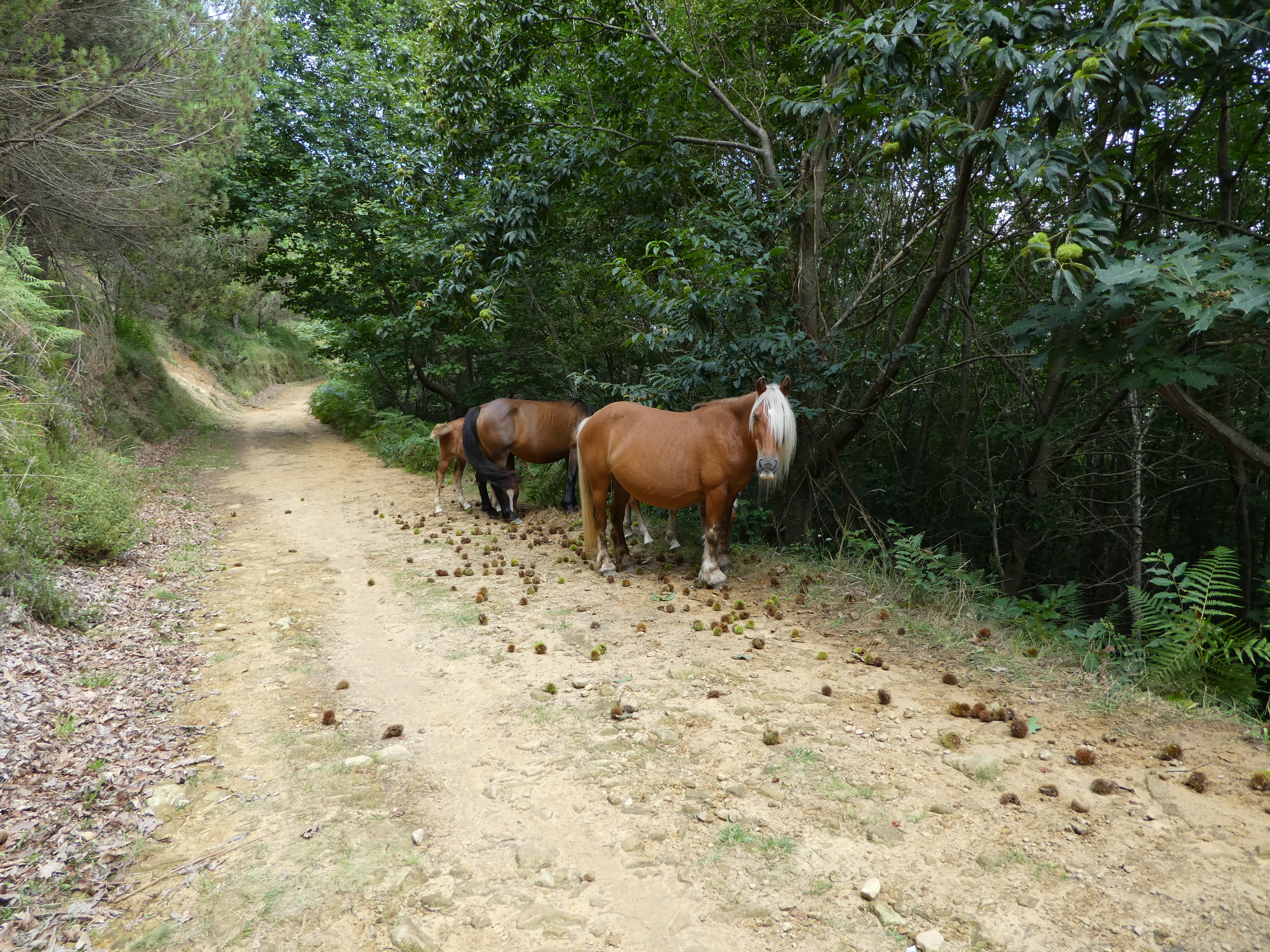
Once on the ridge, it's relatively smooth. I see lots of chestnuts on the ground. And far away, I see some things that are moving... They are horses! Not sure if they are wild horses, but I don't see any human around... Anyway, they don't seem to mind me, on the trail, munching on chestnuts...

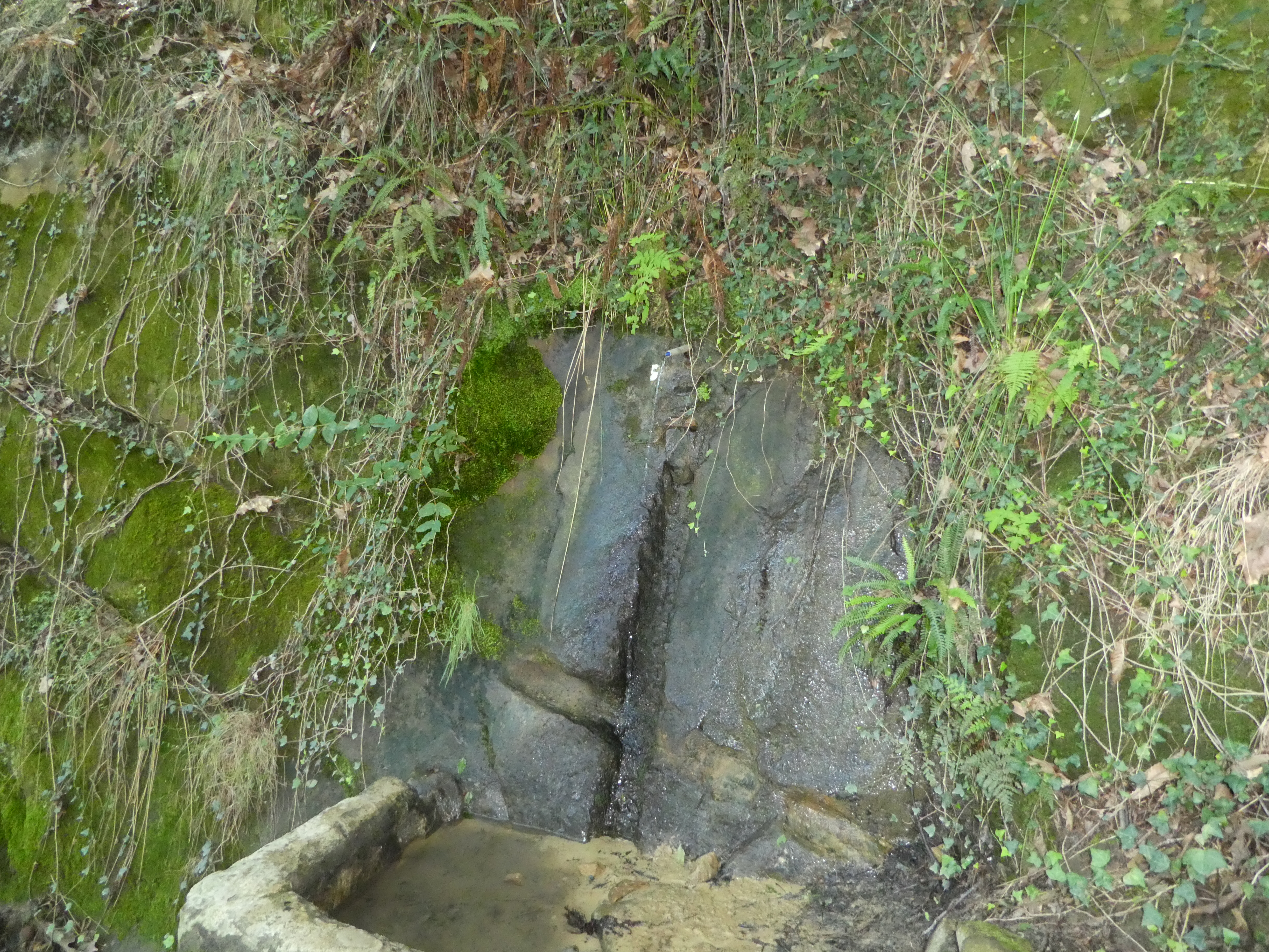
I've been on the trail for nearly 3 hours, and I am running out of water. Still 5 km or so to go until I reach where humans live. I just keep walking under the heat... And then thank goodness, there's water fountain! I drink and drink, and fill up the water bottle. Now, I can finish strong.
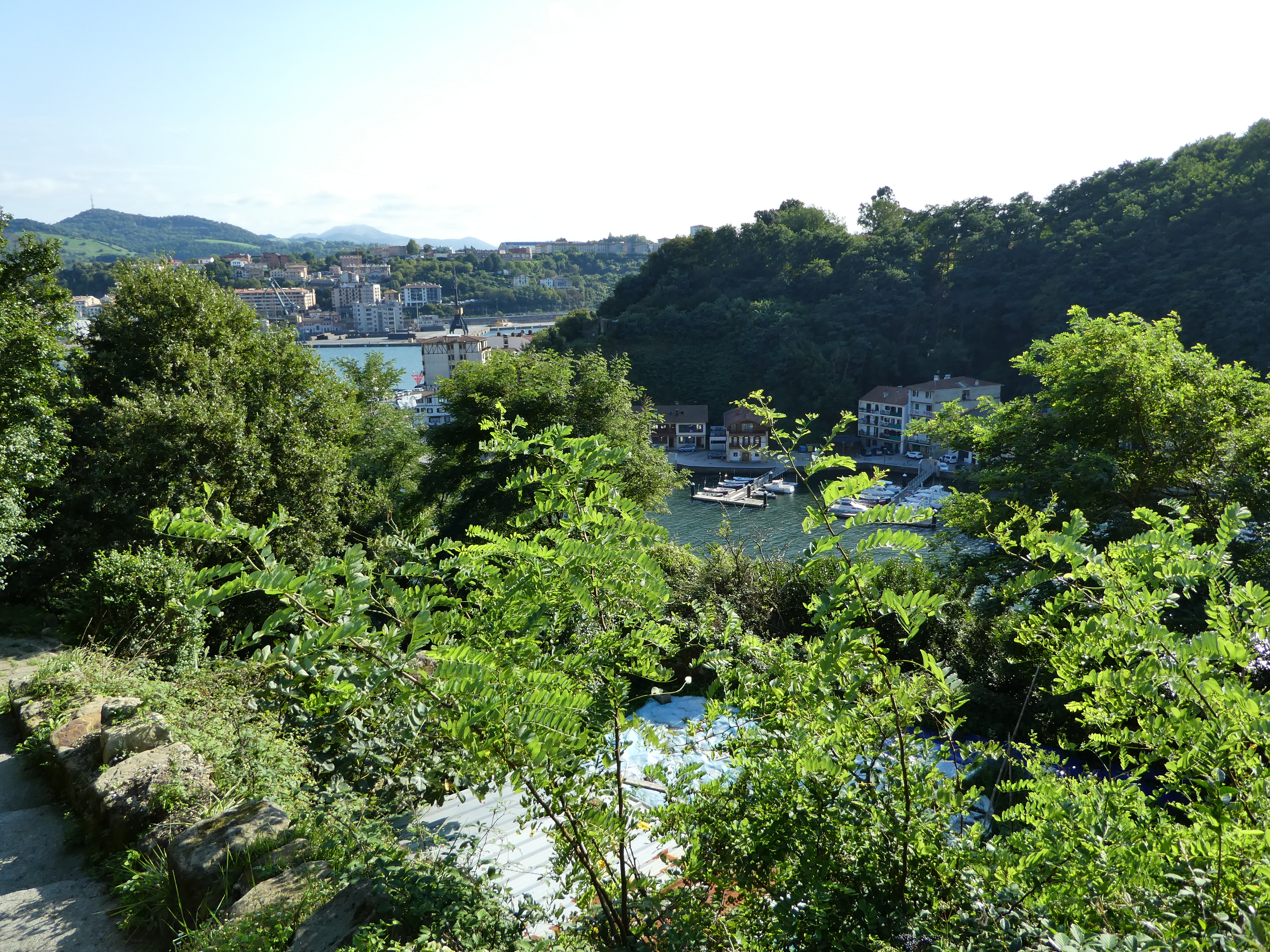
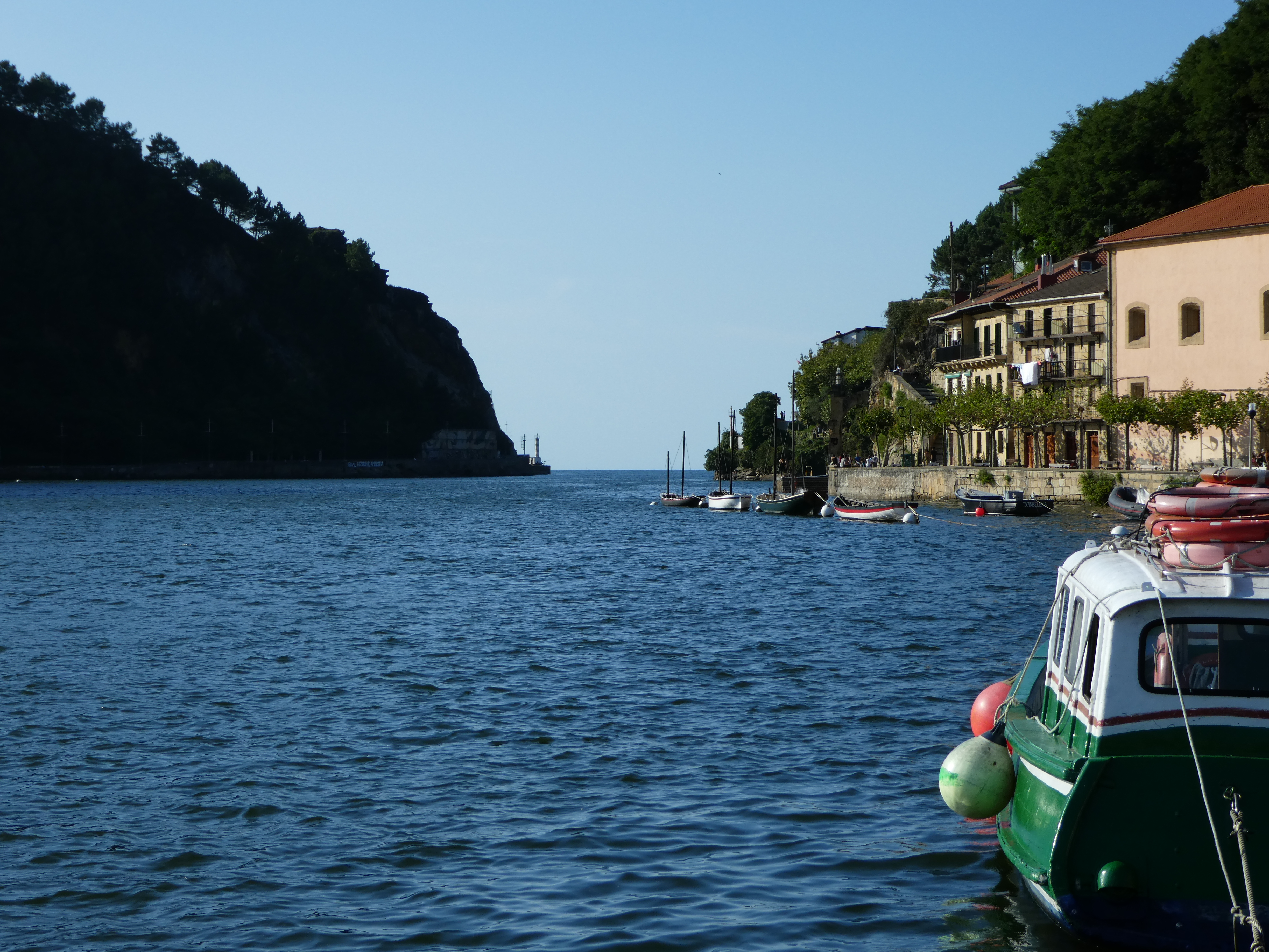
Finally, I reach Pasaia via a small boat. A long (wrong?) day is over.